First Exhibition on Aerospace Information and Satellite Remote Sensing Technology and Equipment (CRSAE 2025)
19 November - 21 November, 2025
Nanjing International Exhibition Center
Nanjing, Jiangsu
No. 88 Longpan Road, Nanjing City, Jiangsu Province
江苏省南京市龙蟠路88号
Nanjing, Jiangsu
No. 88 Longpan Road, Nanjing City, Jiangsu Province
江苏省南京市龙蟠路88号
The aerospace information industry is a strategic emerging industry that is driving high-quality economic and social development at an unprecedented speed, showcasing vast market potential and forming a complete industrial chain. According to relevant statistics, the market scale of China's aerospace information industry reached 726.71 billion yuan in 2023, an increase of 11.15% compared to 2022. By 2025, the industry scale is expected to exceed 2.8 trillion yuan, and by 2030, it will approach 10 trillion yuan.
With the ongoing implementation of the "14th Five-Year Plan" and the "2035 Long-range Goals Outline," the aerospace information industry will continue to strengthen its front-end layout in technological innovation, industry integration, and business models, expanding application scenarios and building a more complete ecological industrial chain. The first Exhibition on Aerospace Information and Satellite Remote Sensing Technology and Equipment (CRSAE 2025) will be held from November 19-21, 2025, at the Nanjing International Exhibition Center in Jiangsu. Organized by the China Association for Remote Sensing Applications, the event aims to create a high-level industry communication platform, bringing together leading companies, research institutions, industry experts, and application entities to explore the latest trends in aerospace information technology, share cutting-edge research achievements and innovative application cases, and promote exchanges and cooperation along the industrial chain from research and development to design, manufacturing, and application terminals, thus contributing to the high-quality development of China's aerospace information and remote sensing satellite technology sector.
The exhibition will cover a range of aerospace information technologies and equipment related to information acquisition, processing, transmission, and applications on aviation, near-space, aerospace, and deep space platforms. It includes but is not limited to commercial aerospace, satellite applications, deep-space exploration, and ground system equipment. Specific exhibits will feature satellite systems such as low-Earth orbit broadband communication satellites and remote sensing satellites; airborne remote sensing devices like high-resolution CCD digital cameras, lightweight optical cameras, multispectral imagers, infrared scanners, laser scanners, magnetometers, synthetic aperture radar, etc.; software for remote sensing image processing, high-definition surveillance equipment, image transmission systems, and laser ranging; and data transmission and communication equipment like satellite data transmission systems, communication link devices, and ground receiving station equipment.
In terms of navigation and control technology, the exhibition will showcase navigation receivers, inertial gyro combined navigation, GPS, GNSS, and automated control systems, autopilots, simulation systems, and control technology devices. Also featured will be communications and data link technology, including satellite communication antennas, wireless links, and ground control devices. Surveying and geographic information equipment will include surveying and measurement devices and geographic information system software.
Drones and aerial remote sensing equipment will include various types of drones and their payloads, such as aerial photogrammetry cameras and high-definition surveillance equipment. Additionally, the application areas will highlight industry application cases utilizing satellite communication, navigation, and remote sensing technologies in urban security, traffic logistics, and marine economies, as well as intelligent city management systems based on satellite remote sensing and navigation technologies. This exhibition will provide participants across the relevant industrial chain a platform for exchange and cooperation, promoting the further development of aerospace information and satellite remote sensing technologies.
Upcoming Related Events
25 June - 26 June, 2026
en 6 meses
2026 China (Beijing) Machine Vision Empowering Intelligent Manufacturing Innovation Development Conference

Industrial Machinery
High-Tech Materials/Technology
Computers, Communications and Electronic Equipment

The 2026 China (Beijing) Machine Vision Empowering Intelligent Manufacturing Innovation Development Conference will be held on June 25-26 at the Beijing International Conference Center, focusing on the latest technologies and developments in intelligent manufacturing and machine vision.
Hosted by the Machine Vision Industry Alliance, the conference aims to build a cutting-edge exchange platform for the industry, covering core exhibits like cameras, smart visual equipment, and AI solutions.
26 June - 28 June, 2026
en 6 meses
2026 Beijing International Low Altitude Economy and Drone Systems Industry Exhibition

Public Safety
Heating and Cooling Equipment
Computers, Communications and Electronic Equipment

The 2026 Beijing International Low Altitude Economy and Drone Systems Industry Exhibition will be held from June 26 to 28, 2026, at the Shougang Exhibition Center in Beijing, aimed at promoting the development of the low altitude economy and drone industry, providing a platform for academic exchanges and business cooperation, and attracting global industry participants.
26 June - 28 June, 2026
en 6 meses
2026 17th Beijing International Disaster Prevention and Mitigation Emergency Safety Industry Expo

Public Safety
Photoelectric Technology
Computers, Communications and Electronic Equipment

The 2026 Beijing International Disaster Prevention and Mitigation Emergency Safety Industry Expo will be held from June 26 to 28, 2026, in Beijing, focusing on emergency safety, bringing together industry leaders, showcasing advanced technologies, and promoting exchange and cooperation.
1 July - 3 July, 2026
en 6 meses
2026 Munich Shanghai Electronics Show

Computers, Communications and Electronic Equipment

The Munich Shanghai Electronics Show is a key event in the electronics industry. It focuses on areas like new energy vehicles, smart cars, and green energy, showcasing diverse electronic technology products and solutions.
22 July - 25 July, 2026
en 6 meses
2026 International Low-Altitude Economy Expo

Aeronautics and Astronautics

The 2026 International Low-Altitude Economy Expo will be held in Shanghai from July 22 to 25, 2026, covering 100,000 square meters, expected to attract 100,000 visitors, focusing on new technologies and applications in the low-altitude economy.
8 August - 12 August, 2026
en 7 meses
2026 World Robotics Conference and Expo (Beijing)

Industrial Machinery
Engineering Machinery
High-Tech Materials/Technology
Computers, Communications and Electronic Equipment

The 2026 World Robotics Conference and Expo will focus on "Artificial Intelligence + Robotics," gathering top experts and companies globally to discuss innovation and development in the robotics field.
12 August - 14 August, 2026
en 7 meses
Shanghai International Intelligent Automotive Electronics Technology Innovation Exhibition 2026

Automobiles
Computers, Communications and Electronic Equipment

The Shanghai International Intelligent Automotive Electronics Technology Innovation Exhibition 2026 will be held from August 12 to August 14 at the Shanghai New International Expo Center, attracting over 70,000 professional visitors, an exhibition area of 70,000 square meters, and over 1,200 brands, covering multi-dimensional innovations in intelligent vehicles and their electronic systems.
12 August - 14 August, 2026
en 7 meses
2026 21st Shanghai International Smart Cabin and Vehicle Display Technology Exhibition

Automobiles
Computers, Communications and Electronic Equipment
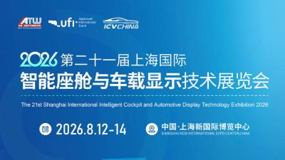
The 2026 21st Shanghai International Smart Cabin and Vehicle Display Technology Exhibition will take place in Shanghai, attracting over 70,000 attendees and 1,200 exhibitors, showcasing the latest advancements in smart cabin and vehicle display technologies.